


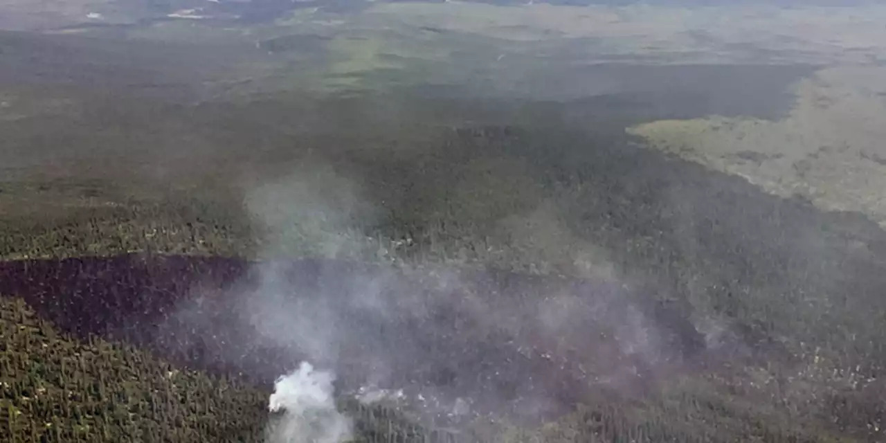
Just over 11,000 acres have burned in Alaska this year, marking a huge increase from the roughly 2,000 acres we were at early this week.
The surge of activity is thanks to the hot and dry conditions through Interior Alaska, combined with an increased chance for thunderstorm activity. Just this week, the state has seen well over 20,000 lightning strikes, leading to 18 new fires reported in the last 24 hours. Most of the thunderstorms have been through the Interior, although few have been a bit further west across the state.
In addition to the wildfires, abnormally dry conditions continue to pop up across the state. The latest drought monitor for Alaska shows that roughly 4% of the state is experiencing abnormally dry conditions, with all locations being in the Copper River Basin and through the Interior. It’s these areas we’ll want to watch for additional wildfires, as thunderstorm activity increases into the afternoon hours. A combination of both smoky skies from Canada and wildfires burning across the state is leading to moderate air quality in Fairbanks. There should be some improvement through the day, as smoke shifts westward and dissipates.
While the Interior continues to deal with hot and dry conditions, widespread rain has returned to Southwest Alaska. The activity will slowly taper off through the day as the system moves north, taking the rain with it.
Meanwhile, in Southcentral Alaska, things continue to remain on the drier side. For nearly a week we’ve been on the dry side, marking the longest such streak since May. It’s a testament to just how wet the summer season has been. Things do change briefly starting tomorrow into the first part of the weekend, as rain builds in from the southwest. While the rain will arrive during the morning for Kodiak Island and southern parts of the Kenai Peninsula, further inland rain isn’t expected until the late afternoon and early evening hours.
While widespread rain doesn’t look likely, we will potentially see less than 0.25 inches of rain for inland locations. The heaviest rain will fall for Kodiak and southern parts of the Kenai, where up to half an inch of rain looks possible.
We’ll end July on a cloudy note, with dry and warmer conditions returning as we welcome in August. It’s looking likely we’ll make another run at 70 degrees for several consecutive days next week.
Source : ALASKANEWS


